
Regional journey · Baikal shores · Nature & trails
Khuzhir, Cape Burkhan and Shaman Rock
A local museum, the old pier, Baikal’s great emblem and sunset over the Maloye More
Photo: Vyacheslav Argenberg, CC BY 4.0
- Duration
- 3–5 h
- Distance
- ≈ 6.1 kmcalculated on the OpenStreetMap footpath network
- Difficulty
- Easy
- Best season
- All year
- Getting around
- On foot
- Start
- The N. M. Revyakin Local History Museum, Khuzhir
- Finish
- Sarai Beach
A walk through Khuzhir and out to Cape Burkhan, the most famous place on Lake Baikal. Shaman Rock is a shrine of Buryat shamanism, so this route is also about how to behave at a sacred site.
About this route
Cape Burkhan, with its twin-peaked Shaman Rock, is one of the holiest places for the Buryat people. You will often see ribbons tied to serge (ritual hitching posts) and offerings. Local people ask visitors not to climb the rock, not to enter the cave and not to leave litter in the guise of “offerings”.
Walk the route in the morning, when it is quiet, or in the evening to finish with sunset over the Maloye More.
The interactive map is unavailable — below is a sketch of the route and the full written itinerary.
The route line was calculated on the OpenStreetMap footpath network and has not been checked on the ground by our editors. The map mirrors the list of stops below; all information is available without the map.
Step-by-step itinerary
-
Stop 1 · Time here: 45 min
The N. M. Revyakin Local History Museum
This small museum is named after the teacher who gathered its collection on Olkhon’s history and nature. It covers the island’s Buryat culture, fishing and village life in the twentieth century.
Opening hours & tickets: Check opening hours on site.
Open in maps: OpenStreetMap · Yandex Maps · 2GIS -
Stop 2 · Time here: 20 min
Khuzhir’s old pier
Getting there. Down to the water, about 600 m.
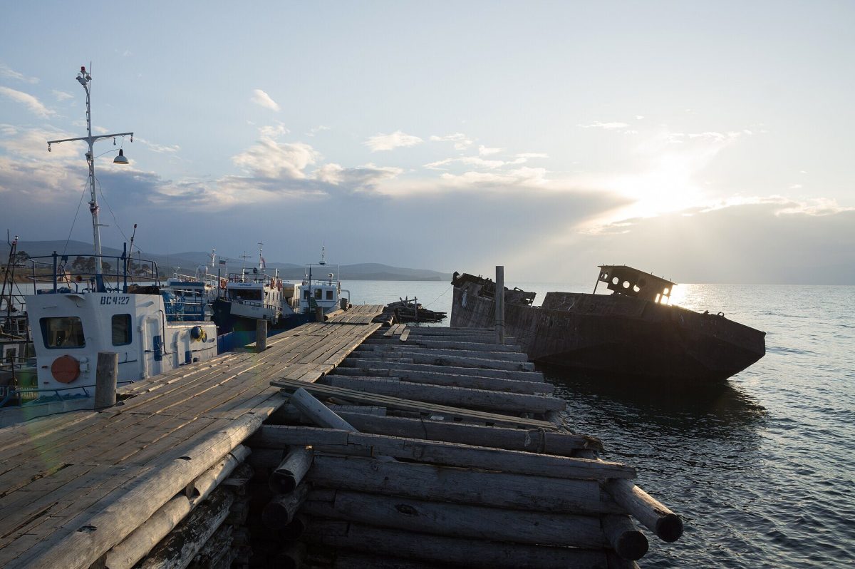 Photo: Vyacheslav Argenberg, CC BY 4.0
The remains of a wooden pier and old boats recall Khuzhir’s past as a fishing village with a fish factory. There are views across the Maloye More to the mainland.
Open in maps: OpenStreetMap · Yandex Maps · 2GIS -
Stop 3 · Time here: 60 min
Cape Burkhan and Shaman Rock
Getting there. North along the shore, about 1.2 km.
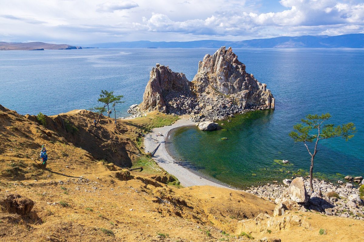 Photo: Vyacheslav Argenberg, CC BY 4.0
The twin-peaked rock of marble and granite is joined to the shore by a narrow neck. For the Buryats it is a sacred place, said to be home to the spirit who rules the island. Serge posts hung with ribbons stand on the shore.
What to look for
The pinkish veins in the rock — exposed marble, at its brightest in the evening light.
Tip
Do not climb the rock or touch the ribbons on the serge.
Open in maps: OpenStreetMap · Yandex Maps · 2GIS -
Stop 4 · Time here: 60 min
Sarai Beach
Getting there. North-east from the cape along the bay, about 2 km.
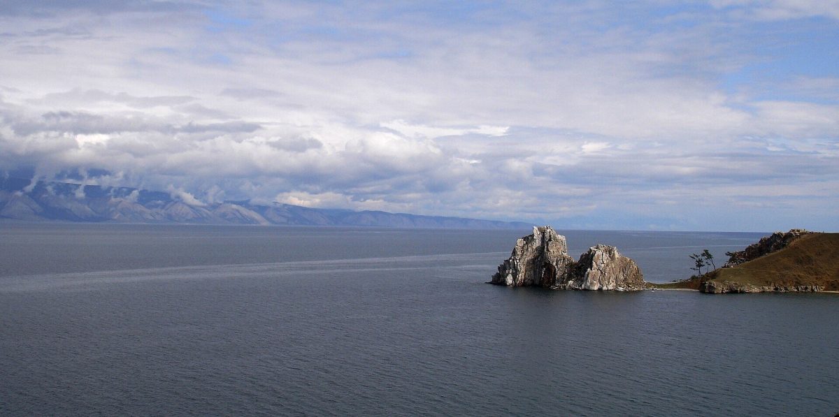 Photo: Елена Парфенова, CC BY-SA 4.0
The long sandy shore of Sarai Bay is one of the best places on the island to walk and swim: the bay warms up faster than the water by the rocks. There is a side view of Shaman Rock.
Open in maps: OpenStreetMap · Yandex Maps · 2GIS (approximate location)
Practical tips
Transport
The whole route is on foot from central Khuzhir.
Practical tips
- The cape is always windy — bring a jacket.
- The best light on Shaman Rock is at sunset.
- Keep to the paths near the cliff edge.
Seasonal notes
Busy by day in summer; early morning and late evening are calmer. In winter Shaman Rock is coated in frozen spray and the ice by the cape can be clear (go onto the ice only where permitted).
Accessibility
Sandy tracks and slopes; paths to the cape cross uneven ground.
Safety and caring for nature
The edges of the cape crumble. In summer do not swim by the rocks — deep, cold water. In winter keep away from cracks and open water near the cape.
Budget
Museum admission; everything else is free. A national park fee may apply in some areas.
Photographs
 Photo: amanderson2, CC BY 2.0
 Photo: Vyacheslav Argenberg, CC BY 4.0
 Photo: Елена Парфенова, CC BY-SA 4.0
Destinations: Olkhon IslandKhuzhir
Related routes

Irkutsk to Khuzhir on Olkhon Island
A road across the steppe, the Olkhon Gate crossing and a first evening on the island
View itinerary: Irkutsk to Khuzhir on Olkhon Island
Olkhon Island: Northern Landscapes and Cape Khoboy
Peschanaya, the marble “Three Brothers” and cliffs above the open lake
View itinerary: Olkhon Island: Northern Landscapes and Cape Khoboy
A Multi-Day Baikal Journey: Irkutsk, Listvyanka, Olkhon and the Western Shore
Six days to see the city, the Angara source, the Maloye More and northern Olkhon without rushing
View itinerary: A Multi-Day Baikal Journey: Irkutsk, Listvyanka, Olkhon and the Western Shore