
Regional journey · Baikal shores · Nature & trails
Listvyanka: Village, Shoreline and Local Attractions
Chersky Stone, the fish market, St Nicholas Church and the start of the Great Baikal Trail
Photo: LxAndrew, CC BY-SA 3.0
- Duration
- 4–6 h
- Difficulty
- Moderate
- Best season
- All year
- Getting around
- On foot
- Start
- The Baikal Museum
- Finish
- The start of the Listvyanka–Bolshie Koty trail
A walk through Listvyanka from the Angara source to the Krestovka valley: the viewpoint at Chersky Stone, the market, the shore, a wooden church and the trailhead for Bolshie Koty. About 6–7 km with one climb.
About this route
Listvyanka stretches several kilometres along the shore, and the best parts are at either end: the Angara source in the west and the Krestovka valley in the east. This route covers the whole village. The climb to Chersky Stone is the hardest part — the path is steep; in season a chairlift may run (check on site).
The interactive map is unavailable — below is a sketch of the route and the full written itinerary.
Schematic: stops are joined by straight lines. This is not a walking track — follow the written directions. The map mirrors the list of stops below; all information is available without the map.
Step-by-step itinerary
-
Stop 1 · Time here: 60 min
The Baikal Museum
 Photo: Brücke-Osteuropa, Public domain
Start at the museum to understand what you are looking at: the depths and age of the lake, the seals and the endemic species.
Open in maps: OpenStreetMap · Yandex Maps · 2GIS Official website -
Stop 2 · Time here: 75 min
Chersky Stone
Getting there. A trail up the slope from the village; a chairlift in season.
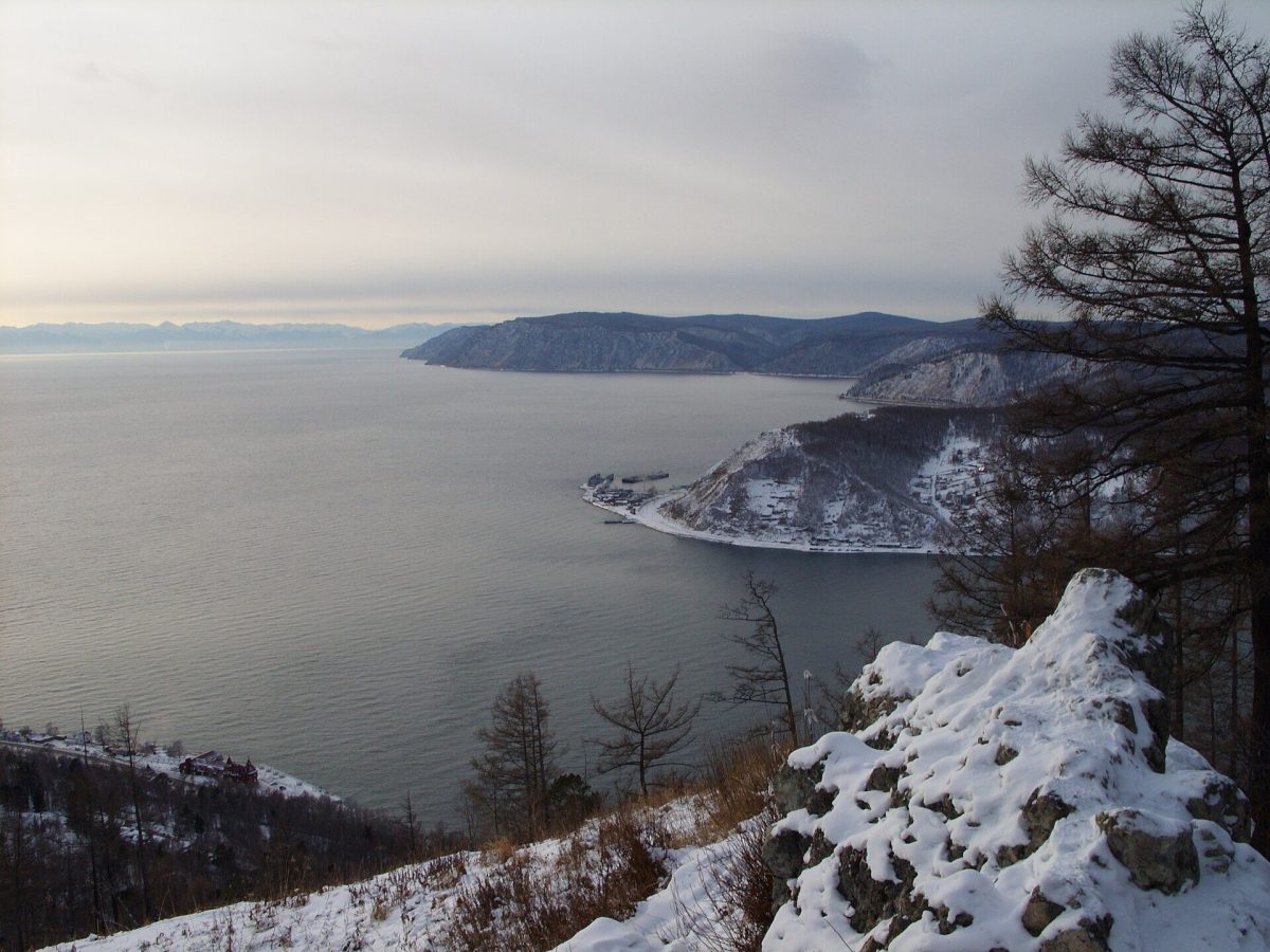 Photo: LxAndrew, CC BY-SA 3.0
This rocky outcrop high above the Angara source is named after Jan Czerski (Ivan Chersky), the Polish exile who became one of the first geologists of Baikal. From the platform you see the Angara pouring out of the lake, and on the far bank Port Baikal and the start of the Circum-Baikal Railway.
What to look for
The Shaman Stone in mid-stream, and the colour of the water where lake becomes river.
Open in maps: OpenStreetMap · Yandex Maps · 2GIS -
Stop 3 · Time here: 30 min
The fish market by the pier
Getting there. Down to the shore, about 1 km.
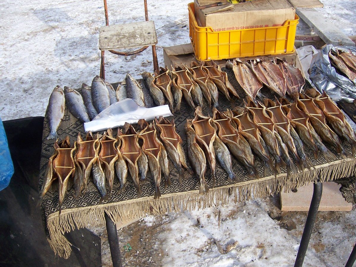 Photo: Brücke-Osteuropa, Public domain
Smoked fish, pine nuts and souvenirs. Next door is Rogatka pier, where the ferry leaves for Port Baikal.
Open in maps: OpenStreetMap · Yandex Maps · 2GIS -
Stop 4 · Time here: 30 min
St Nicholas Church
Getting there. East along the shore, then up the Krestovka valley, about 3 km.
A small nineteenth-century wooden church in the Krestovka valley — the oldest-feeling part of Listvyanka, quiet and very different from the tourist waterfront.
Open in maps: OpenStreetMap · Yandex Maps · 2GIS -
Stop 5 · Time here: 30 min
The start of the Bolshie Koty trail
Getting there. The eastern edge of the village, about 2 km.
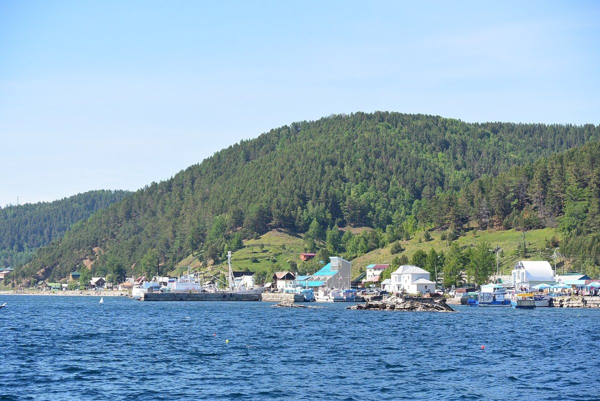 Photo: Thomas D. Fischer, CC BY-SA 4.0
This is the start of one of the best-known sections of the Great Baikal Trail — about 20 km along the shore to the village of Bolshie Koty. Even if you do not go far, walk the first kilometre: here Baikal is already free of crowds.
Tip
If you decide to go on to Bolshie Koty, start early, carry water and know how you will get back (by boat in summer).
Open in maps: OpenStreetMap · Yandex Maps · 2GIS (approximate location)
 Photo:
Practical tips
Transport
For getting to Listvyanka, see the route “Irkutsk to Listvyanka”. Within the village, minibuses run along the main road.
Practical tips
- Climb Chersky Stone in the morning — the light is better for the view of the source.
- Good footwear is essential.
- Do not go far along the Bolshie Koty trail unprepared — it is a full day’s hike.
Seasonal notes
Everything is open in summer. In winter the path up Chersky Stone can be icy, but the view of the steaming source is spectacular.
Accessibility
A level walk along the shore; the climb to the viewpoint is steep.
Safety and caring for nature
Forest paths are tick territory from May to July. Do not walk on the ice by the source. The Bolshie Koty trail crosses steep slopes above the water.
Budget
Baikal Museum admission and the chairlift if you use it; the walking is free.
Photographs
 Photo: Thomas D. Fischer, CC BY-SA 4.0
 Photo: Brücke-Osteuropa, Public domain
 Photo: Pierre André Leclercq, CC BY-SA 4.0
Destinations: Listvyanka
Related routes

The Source of the Angara River
Upstream from the dam and the icebreaker to the Shaman Stone and Port Baikal
View itinerary: The Source of the Angara RiverIrkutsk to Listvyanka: First Encounter with Baikal
The Taltsy museum, the source of the Angara and the Baikal Museum in one day
View itinerary: Irkutsk to Listvyanka: First Encounter with Baikal
Bolshoye Goloustnoye and the Western Shore
A wooden village, the Goloustnaya valley and the calmest shore near Irkutsk
View itinerary: Bolshoye Goloustnoye and the Western Shore