
Regional journey · Baikal shores · Nature & trails
Bolshoye Goloustnoye and the Western Shore
A wooden village, the Goloustnaya valley and the calmest shore near Irkutsk
Photo: Hfdelattre, CC BY-SA 4.0
- Duration
- 8–10 h
- Distance
- ≈ 110 kmapproximate
- Difficulty
- Easy
- Best season
- All year
- Getting around
- Public transport
- Start
- Irkutsk bus station
- Finish
- The Baikal shore at Bolshoye Goloustnoye
Bolshoye Goloustnoye is the alternative to Listvyanka for people who want quiet. A road through the taiga brings you to the wide valley of the Goloustnaya River, where an old village sits on the shore of the open lake.
About this route
You come here for space rather than sights: the valley, a delta of channels, a wooden church and a shoreline running to the horizon. In winter it is one of the most accessible places for smooth clear ice near the shore.
Buses are few, so a day trip takes planning. It is easier by car, or with a night in the village.
The interactive map is unavailable — below is a sketch of the route and the full written itinerary.
Schematic: stops are joined by straight lines. This is not a walking track — follow the written directions. The map mirrors the list of stops below; all information is available without the map.
Step-by-step itinerary
-
Stop 1 · Time here: 20 min
Irkutsk bus station
Buses to Bolshoye Goloustnoye run a few times a day. Buy a return or note the last departure.
Open in maps: OpenStreetMap · Yandex Maps · 2GIS -
Stop 2 · Time here: 30 min
St Nicholas Church
Getting there. About 2 hours by road through the taiga.
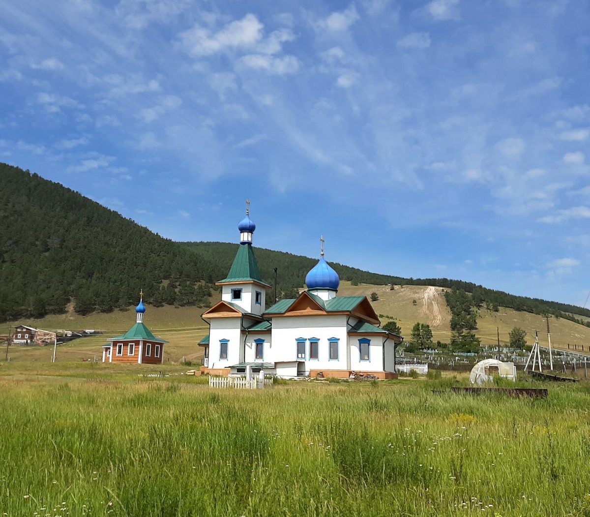 Photo: Andrijko Z., CC BY-SA 4.0
The wooden church is the village landmark, with a view over the whole Goloustnaya valley and the lake shore.
Open in maps: OpenStreetMap · Yandex Maps · 2GIS -
Stop 3 · Time here: 90 min
The Goloustnaya delta
Getting there. Through the village to the river, about 1.5 km.
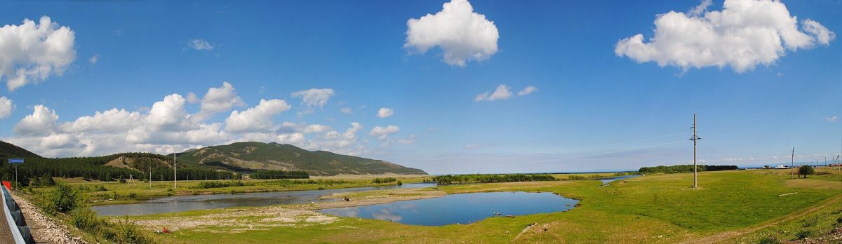 Photo: Виктория Шерина, CC BY-SA 4.0
Before entering Baikal the river splits into channels. Summer brings meadows and birds; winter, ice fields with frozen methane bubbles and pressure ridges.
What to look for
In winter, white “bubbles” deep in the ice — gas frozen at different depths.
Open in maps: OpenStreetMap · Yandex Maps · 2GIS (approximate location) -
Stop 4 · Time here: 60 min
The Baikal shore
Getting there. Along the shore from the village.
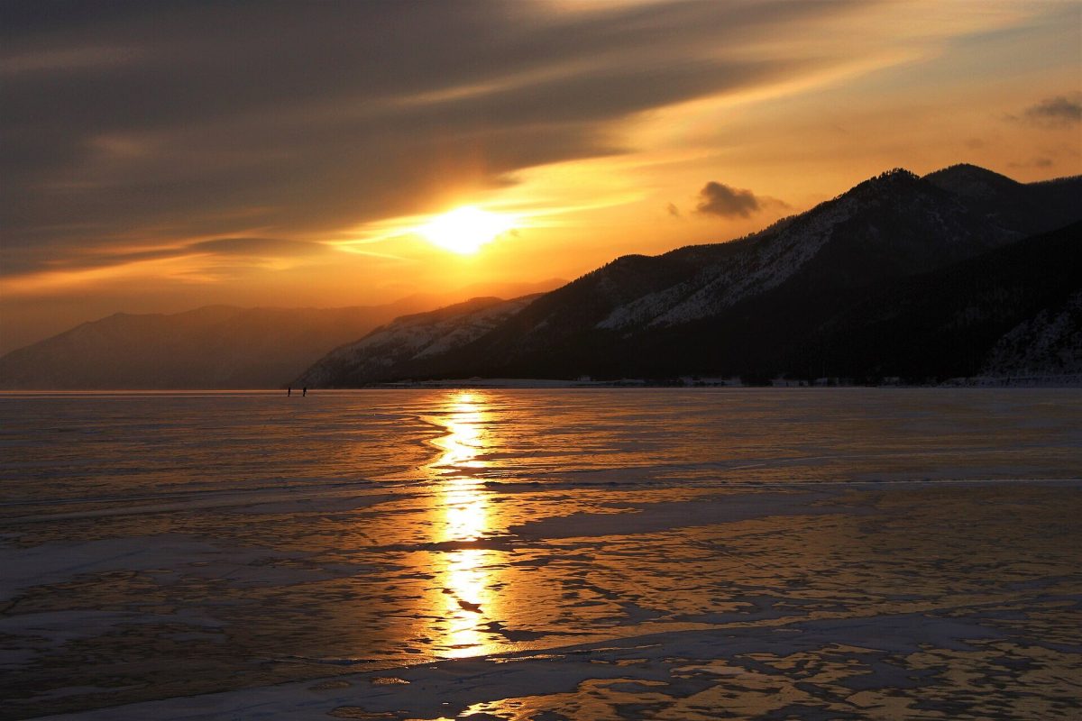 Photo: Hfdelattre, CC BY-SA 4.0
On clear days you can see the Khamar-Daban range across the lake on the southern shore. In the evening the sun sets behind the coastal hills.
Open in maps: OpenStreetMap · Yandex Maps · 2GIS (approximate location)
Practical tips
Transport
Scheduled bus from Irkutsk bus station (few departures — check your return), taxi or car, about 2 hours. Prepared hikers walk in from Listvyanka along the shore trail over several days.
Practical tips
- Check the last return bus before you set off.
- The village has few cafés — bring food.
- In winter the best ice is along the rocky stretches of shore.
Seasonal notes
Winter brings ice and silence; summer a green valley and cold water; spring and autumn are empty and windy.
Accessibility
Village roads and tracks; the valley is level.
Safety and caring for nature
Ice at the Goloustnaya mouth is thinner than on the open lake. Never drive onto the ice outside official crossings.
Budget
Return bus or taxi; the visit itself is free.
Photographs
 Photo: Andrijko Z., CC BY-SA 4.0
 Photo: Виктория Шерина, CC BY-SA 4.0
 Photo: Sergey Pesterev, CC BY-SA 4.0
Destinations: Bolshoye Goloustnoye
Related routes

Listvyanka: Village, Shoreline and Local Attractions
Chersky Stone, the fish market, St Nicholas Church and the start of the Great Baikal Trail
View itinerary: Listvyanka: Village, Shoreline and Local Attractions
A Multi-Day Baikal Journey: Irkutsk, Listvyanka, Olkhon and the Western Shore
Six days to see the city, the Angara source, the Maloye More and northern Olkhon without rushing
View itinerary: A Multi-Day Baikal Journey: Irkutsk, Listvyanka, Olkhon and the Western Shore
Irkutsk to Listvyanka: First Encounter with Baikal
The Taltsy museum, the source of the Angara and the Baikal Museum in one day
View itinerary: Irkutsk to Listvyanka: First Encounter with BaikalRead before you go

Seasonal Travel 1 min read
Baikal in Winter: Ice, Light and Safety
Winter Baikal means clear ice laced with cracks, pressure ridges, ice grottoes and sunshine almost every day. When to go, where to see the ice and which safety rules you…