
Regional journey · City history · Baikal shores · Railways
The Circum-Baikal Railway and Port Baikal
From Slyudyanka along the lake through tunnels and galleries — then by ferry to Listvyanka
Photo: Vyacheslav Argenberg, CC BY 4.0
- Duration
- 10–13 h
- Distance
- ≈ 89 kmapproximate
- Difficulty
- Moderate
- Best season
- All year
- Getting around
- By train
- Start
- Irkutsk-Passazhirsky station
- Finish
- Listvyanka (by ferry from Port Baikal)
About 89 km of the old Trans-Siberian along the south-western shore of Baikal: dozens of tunnels, stone galleries, bridges and retaining walls right above the water. This route covers the whole Circum-Baikal line from Slyudyanka to Port Baikal, returning to Irkutsk via Listvyanka.
About this route
The Circum-Baikal Railway was built in the early twentieth century as the most difficult and expensive stretch of the Trans-Siberian. When the Irkutsk dam flooded the section along the Angara in the 1950s, the main line was moved over the mountains and the Circum-Baikal became a dead-end branch — which is why it has hardly changed.
There are two quite different ways to ride it: the suburban train (slow, a few days a week, stopping everywhere) or a tourist train with a programme. The route described here is the independent one: suburban train plus ferry.
The interactive map is unavailable — below is a sketch of the route and the full written itinerary.
Schematic: stops are joined by straight lines. This is not a walking track — follow the written directions. The map mirrors the list of stops below; all information is available without the map.
Step-by-step itinerary
-
Stop 1 · Time here: 20 min
Irkutsk-Passazhirsky station
The Trans-Siberian station on the left bank of the Angara. Morning suburban trains run over the pass to Slyudyanka.
Open in maps: OpenStreetMap · Yandex Maps · 2GIS -
Stop 2 · Time here: 30 min
Slyudyanka
Getting there. By train over the pass, several hours.
 Photo: SJabberwocky, CC BY-SA 4.0
Slyudyanka-1 station, faced with local marble, was built in the early twentieth century. The Circum-Baikal line begins here.
Open in maps: OpenStreetMap · Yandex Maps · 2GIS -
Stop 3 · Time here: 10 min
Kultuk
Getting there. The first kilometres of the line.
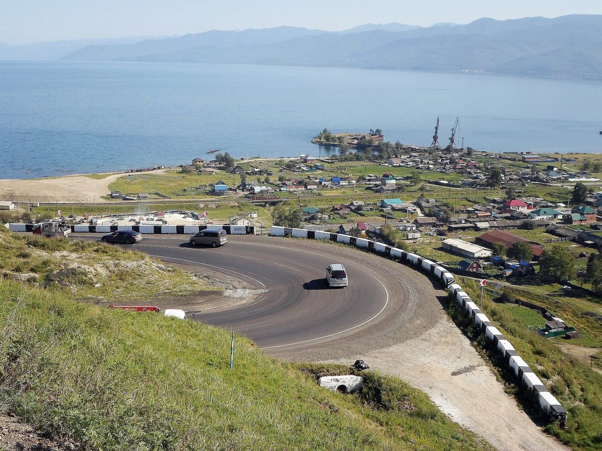 Photo: Alava, CC BY-SA 4.0
A village at the south-western tip of Baikal, where the line begins to hug the water.
Open in maps: OpenStreetMap · Yandex Maps · 2GIS (approximate location) -
Stop 4 · Time here: 10 min
Angasolka
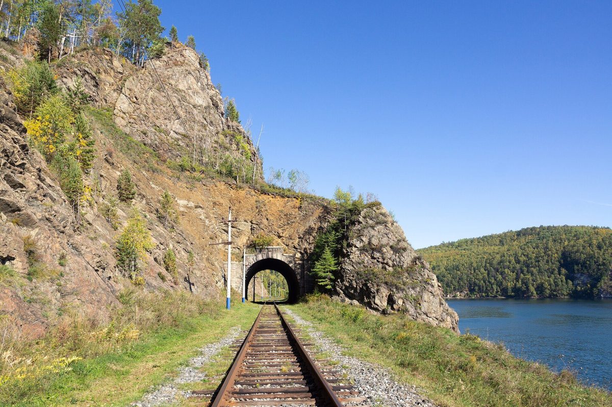 Photo: Vyacheslav Argenberg, CC BY 4.0
Beyond Angasolka the tunnels begin — some short, others hundreds of metres long. Their portals are faced with dressed stone.
What to look for
The stonework of the portals: each tunnel has its own number and design.
Open in maps: OpenStreetMap · Yandex Maps · 2GIS (approximate location) -
Stop 5 · Time here: 15 min
Marituy
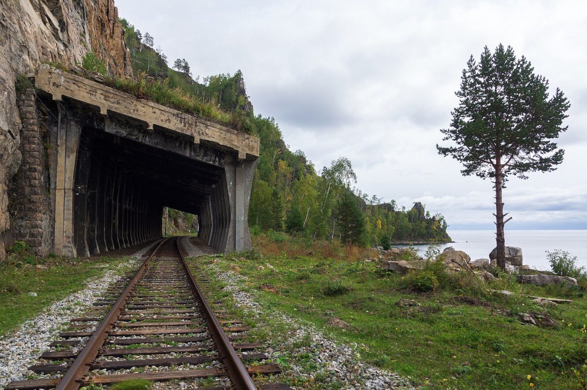 Photo: Vyacheslav Argenberg, CC BY 4.0
A mid-way station. Around it are the line’s most striking structures: galleries that shield the track from rockfall, and arched bridges across the side valleys.
Open in maps: OpenStreetMap · Yandex Maps · 2GIS (approximate location) -
Stop 6 · Time here: 15 min
Polovinnaya
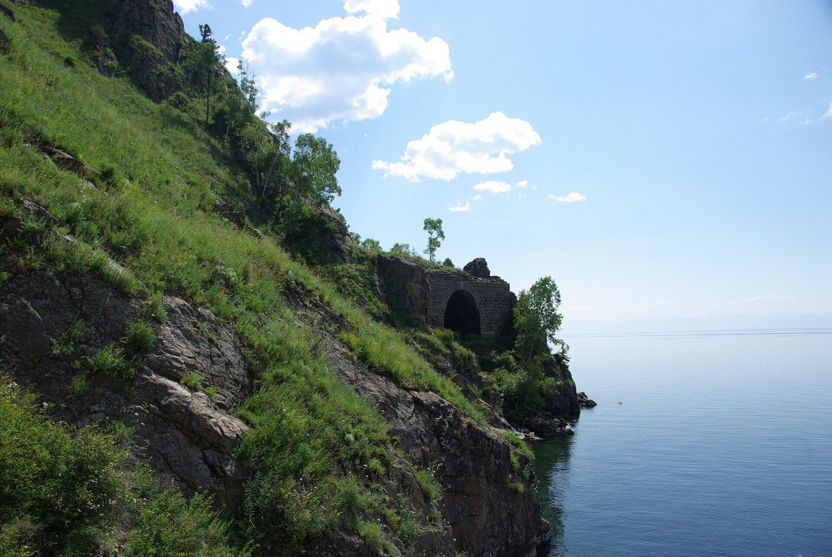 Photo: Artem Svetlov from Moscow, Russia, CC BY 2.0
The name means “halfway” — midway between Slyudyanka and Port Baikal. Some of the old structures here are abandoned and slowly crumbling.
Open in maps: OpenStreetMap · Yandex Maps · 2GIS (approximate location) -
Stop 7 · Time here: 30 min
Port Baikal
Getting there. The end of the line.
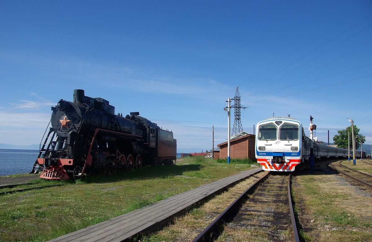 Photo: Artem Svetlov from Moscow, Russia, CC BY 2.0
In the early twentieth century the icebreaker-ferry Baikal carried trains across the lake from here. Today it is a quiet village steeped in railway history, looking across to Listvyanka.
Open in maps: OpenStreetMap · Yandex Maps · 2GIS (approximate location) -
Stop 8 · Time here: 30 min
Ferry to Listvyanka
Getting there. A short crossing over the Angara source.
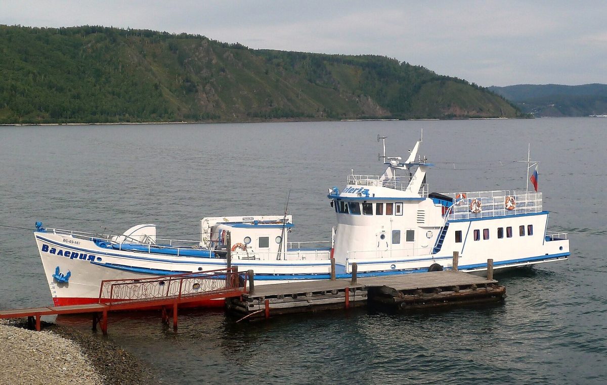 Photo: Pierre André Leclercq, CC BY-SA 4.0
The ferry docks at Rogatka pier in Listvyanka. From there, take a bus or taxi back to Irkutsk.
Opening hours & tickets: Timetable from VSRP.
Open in maps: OpenStreetMap · Yandex Maps · 2GIS
 Photo:
 Photo:
 Photo:
Practical tips
Transport
- Irkutsk → Slyudyanka: an early suburban or long-distance train.
- Slyudyanka → Port Baikal: the suburban train along the Circum-Baikal line (not every day).
- Port Baikal → Listvyanka: the ferry across the Angara source.
- Listvyanka → Irkutsk: bus or taxi.
Check every timetable the day before: if the train and ferry do not connect, you may be spending the night in Port Baikal.
Practical tips
- Sit by a window on the lake side (on the right, heading from Slyudyanka).
- Bring food and water — there are no shops along the way.
- You can get off at a station and walk part of the line, rejoining the train on its return (that makes a different trip — plan it in advance).
Seasonal notes
The main season runs from late spring to early autumn. In winter the line operates and the lake below the tunnels is frozen, but days are short.
Accessibility
Suburban carriages have high steps; stations have no platforms in the usual sense.
Safety and caring for nature
This is a working railway: do not walk through tunnels when a train is approaching, and do not climb retaining walls or rocks. Rockfall is possible on the slopes.
Budget
Train tickets to Slyudyanka and along the line, the ferry and the bus from Listvyanka.
Photographs
 Photo: Vyacheslav Argenberg, CC BY 4.0
 Photo: Vyacheslav Argenberg, CC BY 4.0
 Photo: Artem Svetlov from Moscow, Russia, CC BY 2.0
 Photo: Artem Svetlov from Moscow, Russia, CC BY 2.0
Destinations: ListvyankaPort Baikal and the Circum-Baikal RailwaySlyudyanka and the Southern Shore
Related routes

The Source of the Angara River
Upstream from the dam and the icebreaker to the Shaman Stone and Port Baikal
View itinerary: The Source of the Angara RiverSlyudyanka and the Southern Baikal Shore
A marble station, a mineral museum and a shore walk to Cape Shamansky
View itinerary: Slyudyanka and the Southern Baikal Shore
Irkutsk to Listvyanka: First Encounter with Baikal
The Taltsy museum, the source of the Angara and the Baikal Museum in one day
View itinerary: Irkutsk to Listvyanka: First Encounter with BaikalRead before you go
Long Reads 2 min read
The Steel Buckle: the Story of the Circum-Baikal Railway
Lake Baikal was the greatest obstacle on the route of the Trans-Siberian Railway. First, trains were ferried across on an icebreaker; once, rails were laid across the…