
Regional journey · Baikal shores · Nature & trails · Railways
Slyudyanka and the Southern Baikal Shore
A marble station, a mineral museum and a shore walk to Cape Shamansky
Photo: Alava, CC BY-SA 4.0
- Duration
- 9–12 h
- Difficulty
- Moderate
- Best season
- Spring, Summer, Autumn
- Getting around
- Mixed
- Start
- Slyudyanka-1 station
- Finish
- Cape Shamansky (return to Slyudyanka)
A day at the southern tip of Baikal: Slyudyanka’s marble station, a private mineral museum, a shoreline walk to Cape Shamansky and a view of Kultuk from the hairpin road. For prepared hikers there is an option to climb Chersky Peak.
About this route
Slyudyanka grew up around a Trans-Siberian station and its mica and marble deposits — its name comes from slyuda, mica. The Khamar-Daban mountains rise straight above the town, and the lake here is deep and cold.
Climbing Chersky Peak is a separate, serious full-day hike (or overnight trip) with a big height gain. It is not part of this route; if you plan it, set aside a separate day and check the forecast.
The interactive map is unavailable — below is a sketch of the route and the full written itinerary.
Schematic: stops are joined by straight lines. This is not a walking track — follow the written directions. The map mirrors the list of stops below; all information is available without the map.
Step-by-step itinerary
-
Stop 1 · Time here: 30 min
The marble Slyudyanka-1 station
 Photo: SJabberwocky, CC BY-SA 4.0
The early twentieth-century station is faced with local marble — a rarity among railway stations. Trains for the Circum-Baikal line leave from here.
What to look for
The texture of the marble blocks and the facade details.
Open in maps: OpenStreetMap · Yandex Maps · 2GIS -
Stop 2 · Time here: 60 min
The mineral museum
Getting there. About 3 km from the station, on the edge of town.
A private museum with a large collection of minerals from around Baikal — lapis lazuli, marble, mica and much more. The Slyudyanka district is famous among geologists for the variety of its minerals.
Opening hours & tickets: Check opening hours in advance.
Open in maps: OpenStreetMap · Yandex Maps · 2GIS -
Stop 3 · Time here: 2 h
Cape Shamansky
Getting there. North along the shore from town, about 4–5 km.
A rocky headland jutting into Baikal north of Slyudyanka. The shore walk gives a good sense of the southern lake: steep slopes, clear water and pebble beaches.
Open in maps: OpenStreetMap · Yandex Maps · 2GIS -
Stop 4 · Time here: 30 min
Kultuk and the hairpin road (on the way back)
Getting there. By car or bus on the road to Irkutsk.
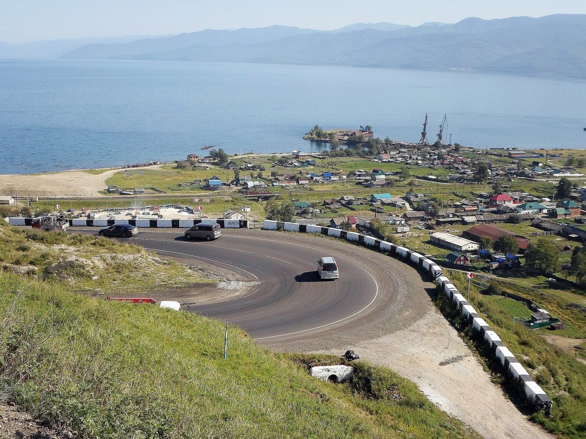 Photo: Alava, CC BY-SA 4.0
From the hairpin bends above Kultuk you see the southern tip of Baikal and the village below. If you are driving, stop at the viewpoint.
Open in maps: OpenStreetMap · Yandex Maps · 2GIS (approximate location)
 Photo:
Practical tips
Transport
From Irkutsk by suburban or long-distance train, bus or car (about 2 hours by road via Kultuk). In Slyudyanka, on foot; Cape Shamansky is about 4–5 km along the shore.
Practical tips
- Check your return train or bus.
- The mineral museum sells specimens — buy only from sellers with documentation, and never collect stones in protected areas.
Seasonal notes
Best from June to September. In winter the Sobolinaya ski resort in neighbouring Baikalsk is open.
Accessibility
The town is level; the shore path to the cape is rocky.
Safety and caring for nature
The shore path runs beside the railway in places — do not walk on the track. Mountain weather changes quickly; the forests have ticks and bears.
Budget
Train or bus fares and mineral museum admission.
Photographs
 Photo:
 Photo:
Destinations: Slyudyanka and the Southern Shore
Related routes

The Circum-Baikal Railway and Port Baikal
From Slyudyanka along the lake through tunnels and galleries — then by ferry to Listvyanka
View itinerary: The Circum-Baikal Railway and Port Baikal
A Multi-Day Baikal Journey: Irkutsk, Listvyanka, Olkhon and the Western Shore
Six days to see the city, the Angara source, the Maloye More and northern Olkhon without rushing
View itinerary: A Multi-Day Baikal Journey: Irkutsk, Listvyanka, Olkhon and the Western Shore
Listvyanka: Village, Shoreline and Local Attractions
Chersky Stone, the fish market, St Nicholas Church and the start of the Great Baikal Trail
View itinerary: Listvyanka: Village, Shoreline and Local AttractionsRead before you go

Long Reads 2 min read
The Steel Buckle: the Story of the Circum-Baikal Railway
Lake Baikal was the greatest obstacle on the route of the Trans-Siberian Railway. First, trains were ferried across on an icebreaker; once, rails were laid across the…